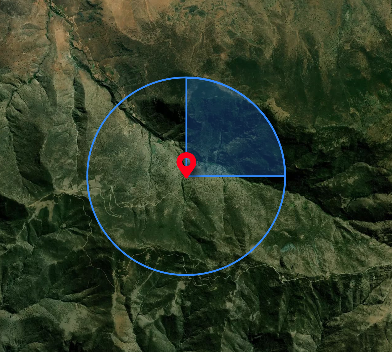
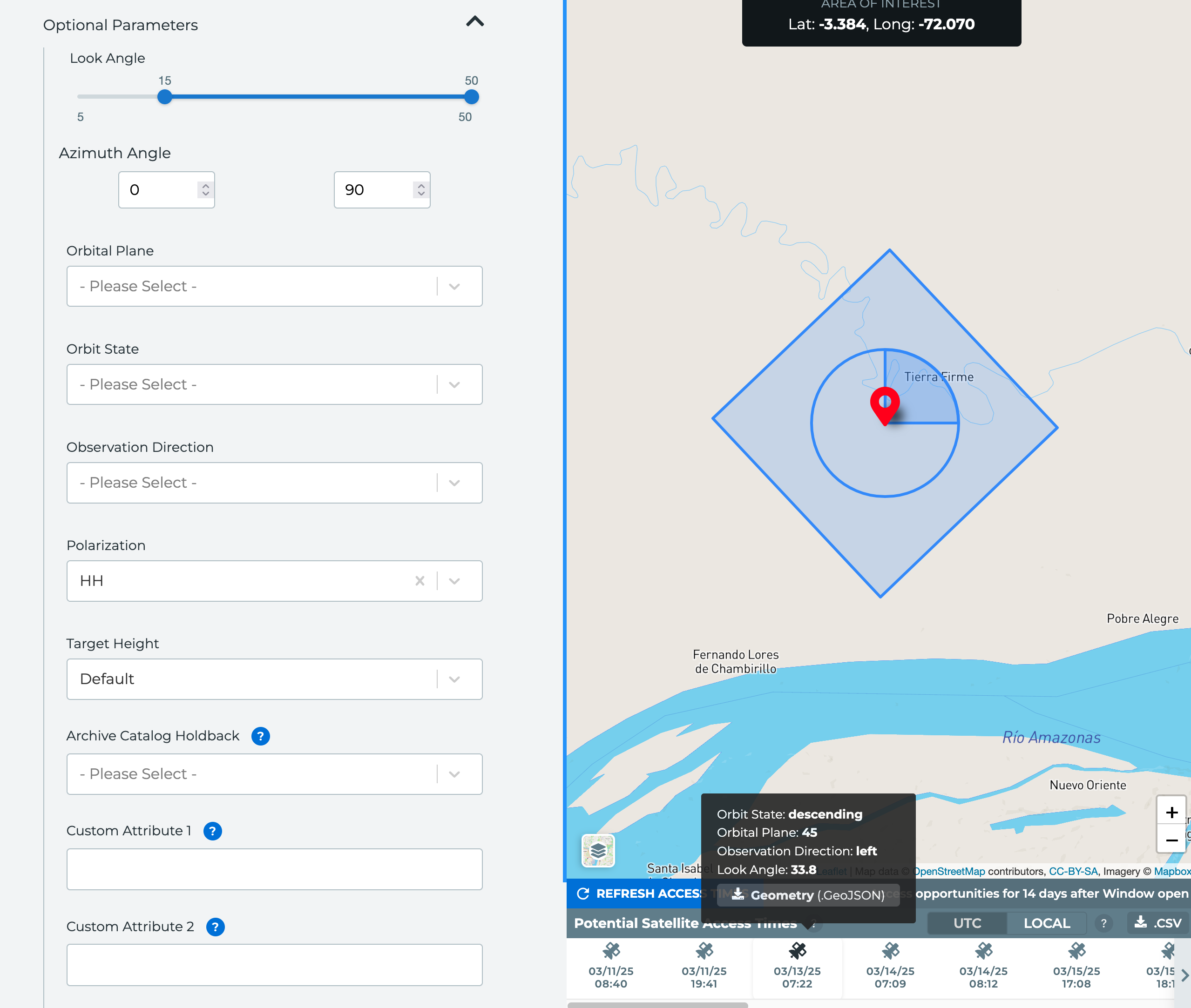
For single and repeat tasking, users can specify the azimuth angle range required for the tasking request by opening the Optional Parameters panel. A circle will appear on the map to denote the full azimuth viewing angle of 0 - 360 degrees.
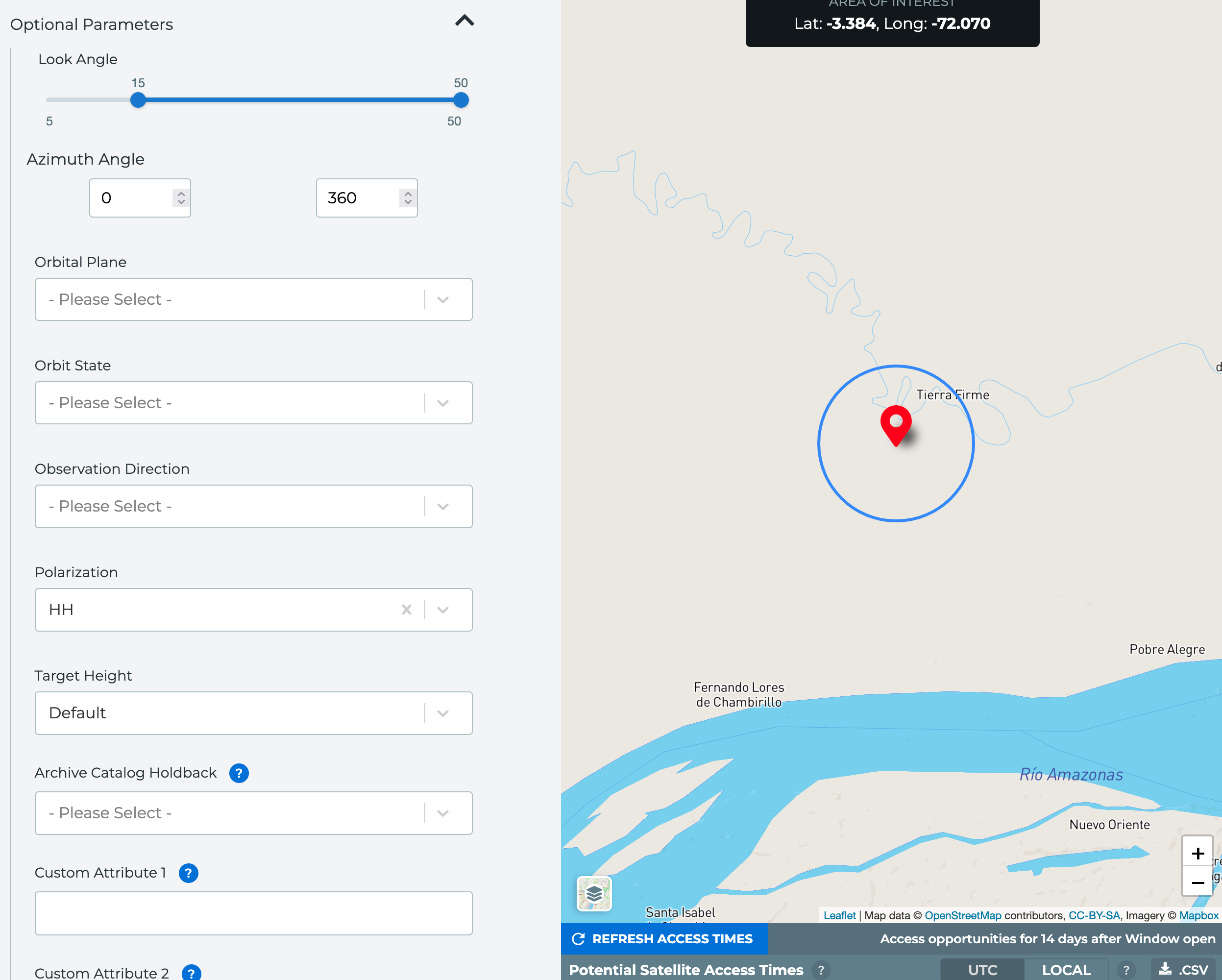
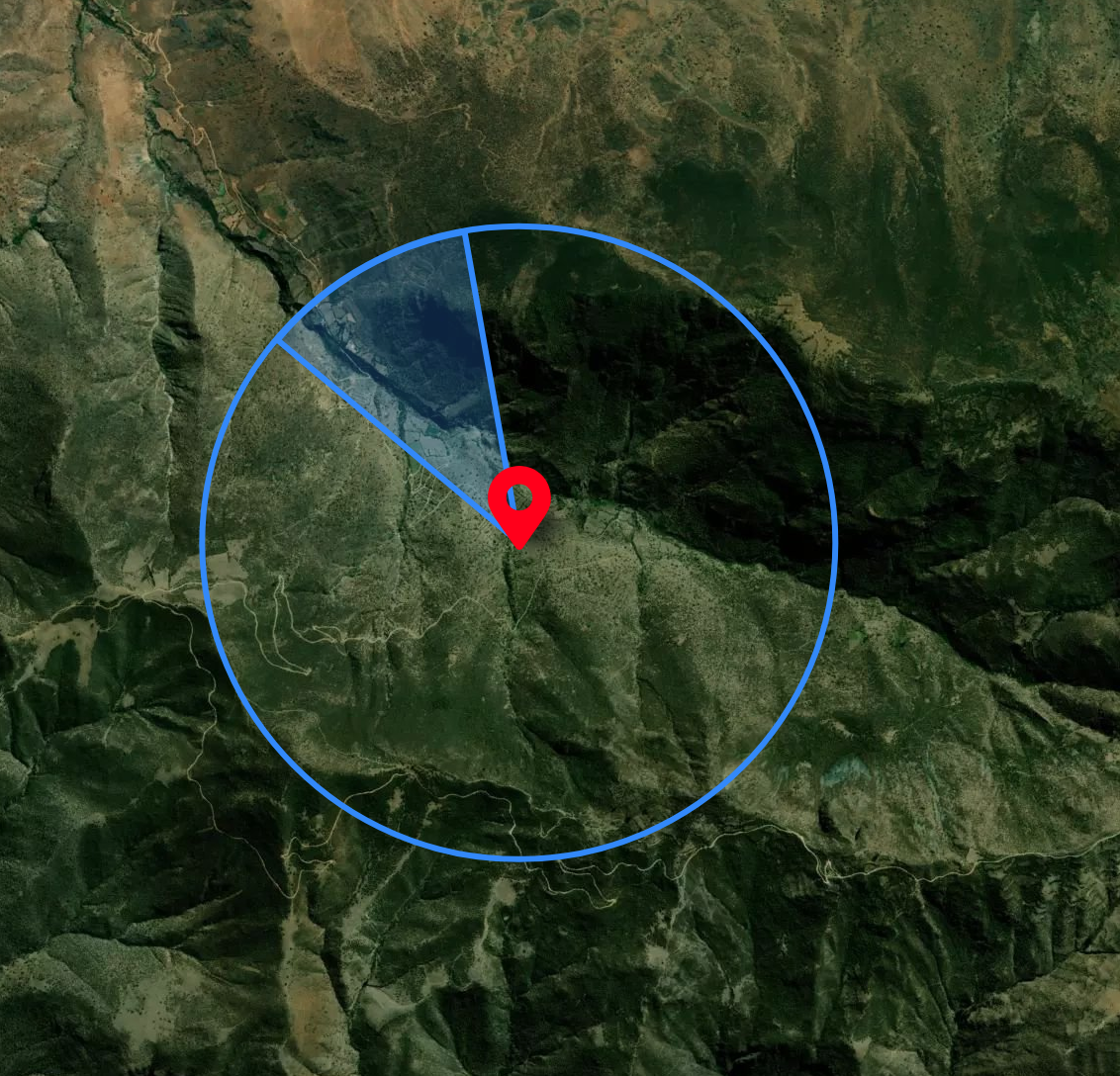
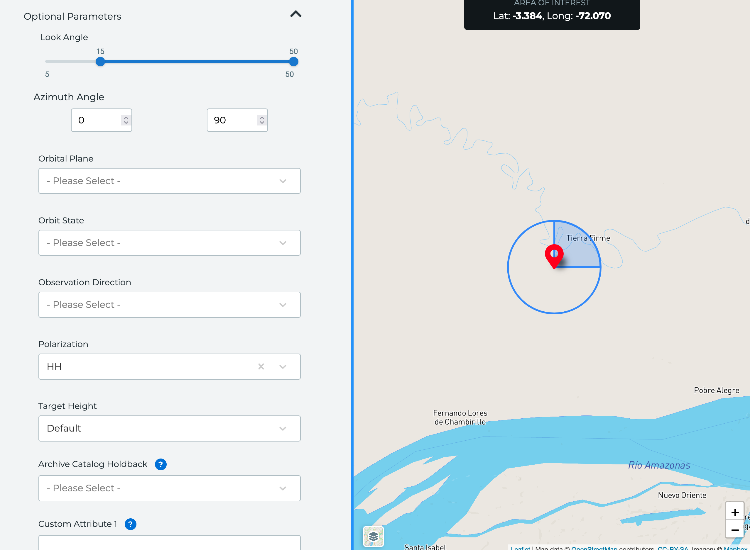
Changing the angles from the default will fill in the circle on the map to show the user-specified angle range. Users can cross the 0 line, submitting a range of 310 to 30 degrees, for example.
Users can continue to toggle on the footprint for each access opportunity by hovering over the opportunity in Mission Awareness.
Capella recommends toggling on the satellite basemap when tasking using the azimuth angle. When looking at the satellite basemap instead of the default map, you can see the angle set above does not align with the terrain. Changing the angle to 310 - 340 degrees matches the terrain.