Analytics applies algorithms to an Area of Interest (AOI). The AOI is central to analytics as it defines the geographic boundary of interest. AOIs may be created by directly drawing the boundary on the map or uploading a file containing the geospatial boundary. This boundary tells the system where (geographically) to collect data. All results are clipped to the interior of this boundary.
The number of AOI's that may be created are determined by contract terms. General details are specified here.
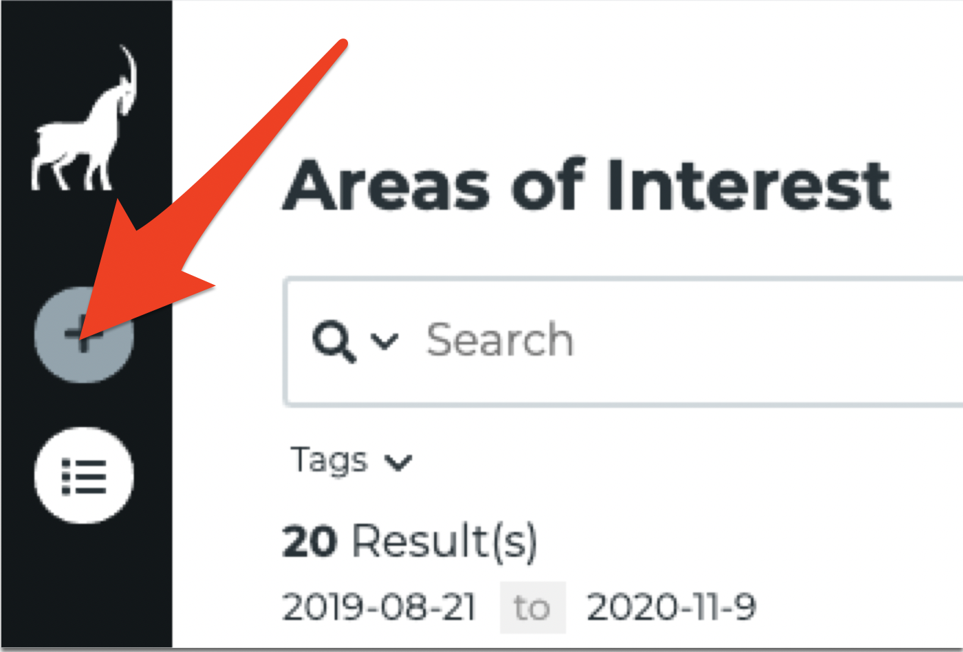
To create an AOI, select the "+" button on the left navigation pane.

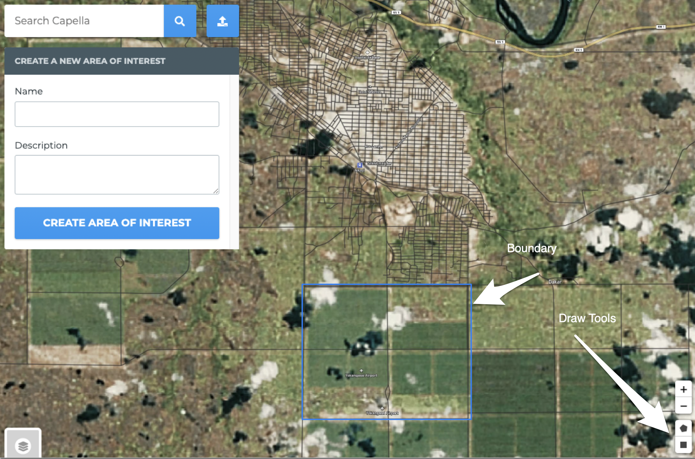
This opens a screen that allows directly drawing an AOI boundary, or uploading a geojson file representing the boundary. The screenshot below shows how an AOI boundary can be drawn on the map.

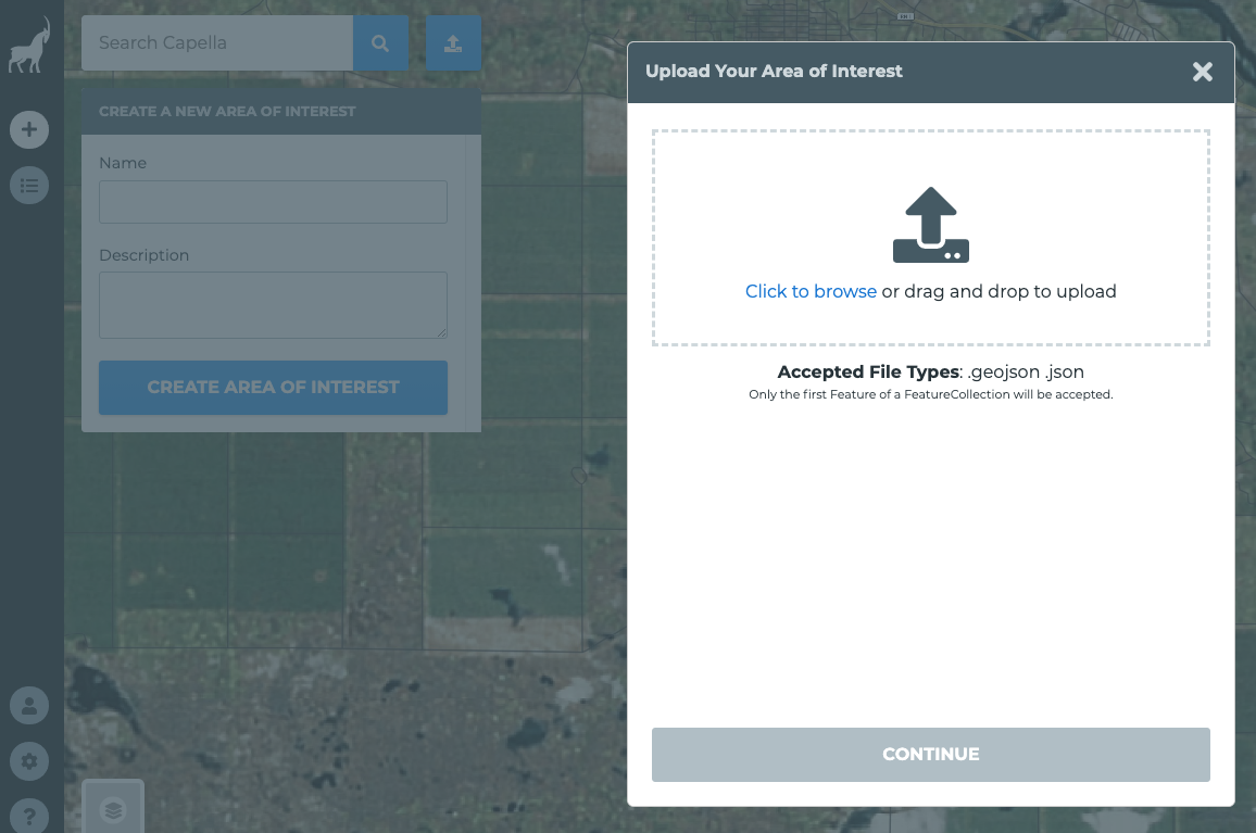
Select the upload button to import a geojson file to represent the boundary.

Once the boundary is created, provide a name for the AOI and an optional description. Both of these fields are searchable from the AOI search screen.
The minimum requirements for AOI creation are:
- Name
- Geometry (drawn or uploaded) that adheres to these restrictions:
The following file types are supported for upload:
- GeoJSON
The AOI size is limited to 150 square kilometers.
Requirements for file upload:
- The file must contain a feature or a feature collection specifying exactly 1 feature.
- The geometry defining the AOI boundary must be a valid polygon or multi-polygon (not a linestring, point, or other geometry).
- AOIs must adhere to the size restrictions.
- AOIs should be created over land to ensure Sentinel-1 collection. (The Sentinel constellation does not collect over open ocean or large bodies of water.)
- Please review additional restrictions detailed here
The website geojson.io provides some useful tools for editing and creating geojson files. You can also convert files from other formats using this tool, such as KML.
Example GeoJSON:
  {
  "type": "FeatureCollection",
  "features": [
    {
      "type": "Feature",
      "properties": {
        "name": "Fishhook Island - BWCA",
        "description": "Boundary Waters Canoe Area Wilderness location."
      },
      "geometry": {
        "type": "Polygon",
        "coordinates": [
          [
            [
              -90.8968448638916,
              48.1376831438553
            ],
            [
              -90.8800220489502,
              48.1376831438553
            ],
            [
              -90.8800220489502,
              48.14959568930188
            ],
            [
              -90.8968448638916,
              48.14959568930188
            ],
            [
              -90.8968448638916,
              48.1376831438553
            ]
          ]
        ]
      }
    }
  ]
}