Global Change Monitoring is limited to where Sentinel-1 data is available. While is is possible to create Areas of Interest over any location on the globe using the Capella Analytics App, the delivery of Global Change Monitoring is subject to sensor constraints.
Open Ocean
The Sentinel-1 sensors do not collect over open ocean. So island locations, shipping lanes, and other off-shore may be impacted by lack of data.
Sentinel-1A Operations and Sentinel-1B End of Mission
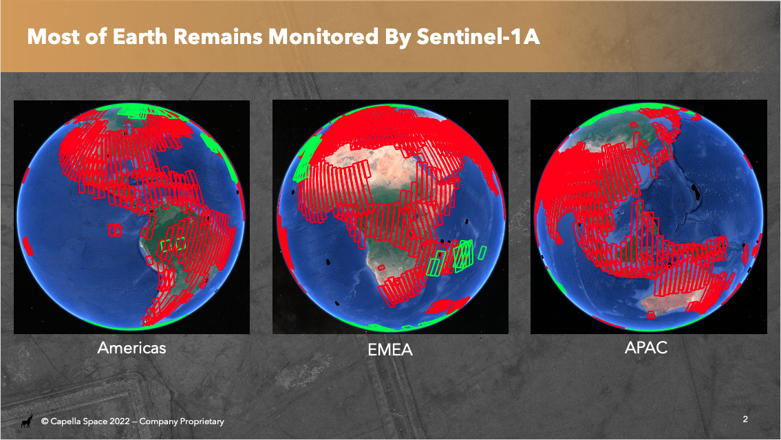
On 23 December 2021, Sentinel-1B suffered a power failure and is no longer able to image. Sentinel-1A continues to operate without issue and provides extensive coverage to much of Earth. Sentinel-1C is planned to be launched in late 2023.
Due to this anomaly, some locations can no longer be analyzed using Global Change Monitoring. Detailed information on geographies that are being collected is available from Copernicus at the link below. This link can be used to download planned S-1A acquisition segments to verify exact coverage availability with a user's Area of Interest: https://sentinels.copernicus.eu/web/sentinel/missions/sentinel-1/observation-scenario/acquisition-segments
The Sentinel-1A acquisition segments are displayed in red below to provide a general sense of areas that continue to be eligible for analysis with Global Change Monitoring.
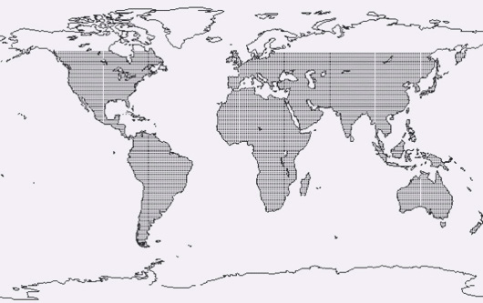
Latitude Constraints
In order to process Sentinel-1 data into a format used by change analytics, an elevation model is required (DEM). This limits Capella's current processing to between 60 north and 56 south as depicted by the shaded elements in the map below.